


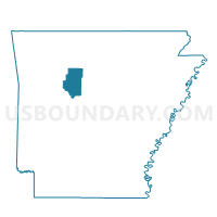
Center Voting District, Pope County, Arkansas
About
Outline

Summary
| Unique Area Identifier | 527731 |
| Name | Center Voting District |
| County | Pope County |
| State | Arkansas |
| Area (square miles) | 14.02 |
| Land Area (square miles) | 13.99 |
| Water Area (square miles) | 0.03 |
| % of Land Area | 99.78 |
| % of Water Area | 0.22 |
| Latitude of the Internal Point | 35.42058850 |
| Longtitude of the Internal Point | -92.94604690 |
Maps


Graphs
Select a template below for downloading or customizing gragh for Center Voting District, Pope County, Arkansas


Neighbors
Neighoring Voting District (by Name) Neighboring Voting District on the Map
- Griffin Voting District, Pope County, AR
- Jackson Voting District, Pope County, AR
- Moreland Voting District, Pope County, AR
- Phoenix Voting District, Pope County, AR
Top 10 Neighboring County Subdivision (by Population) Neighboring County Subdivision on the Map
- Jackson township, Pope County, AR (1,110)
- Griffin township, Pope County, AR (839)
- Moreland township, Pope County, AR (699)
- Center township, Pope County, AR (523)
- Phoenix township, Pope County, AR (313)
Top 10 Neighboring Unified School District (by Population) Neighboring Unified School District on the Map
- Dover School District, AR (7,969)
- Atkins Public Schools, AR (6,607)
- Hector School District, AR (3,627)